ဖုဲင်:Pacific Ocean.png
resolution တန်ထဲင်းယို အဝ်ႏတဝ်း။
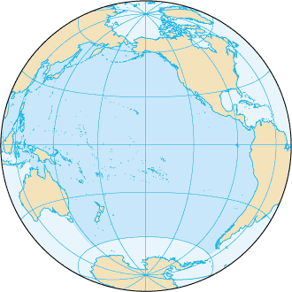
Pacific_Ocean.png (၃၃၀ × ၃၃၀ pixels, ဖုဲင်ပေႏတန် - ၂၈ KB, MIME အစွိုးအမျိုꩻ: image/png)
အအဲဉ်ႏချုတ်
| အွဉ်ႏနယ်ချက် |
English: Pacific Ocean map, tagged in English |
| မွူးနီꩻ | |
| ရွီးခိုႏ | CIA World Factbook |
| တဲမ်းလိတ်သား | CIA World Factbook |
| အခြား ဗားရှင်းများ |
Derivative works of this file: |
.png)

|
This locator map image could be re-created using vector graphics as an SVG file. This has several advantages; see Commons:Media for cleanup for more information. If an SVG form of this image is available, please upload it and afterwards replace this template with
{{vector version available|new image name}}.
It is recommended to name the SVG file “Pacific Ocean.svg”—then the template Vector version available (or Vva) does not need the new image name parameter. |
အွောန်ႏထွော့လုဲင်သိဉ်
This image is in the public domain because it contains materials that originally came from the United States Central Intelligence Agency's World Factbook.
|
 |
မူရင်းတင်ထားသောမှတ်တမ်း
The original description page was here. All following user names refer to en.wikipedia.
This file was originaly uploaded to en.wikipedia as File:Pacificocean.PNG, if you have access to the deleted history, you could to complete this field.
ဖုဲင်မုဲင်တန်ꩻ
ဖေႏကထီႏလꩻ ဖုဲင်နဝ်ꩻမွူးနီꩻအတွိုင်ꩻနဝ်ꩻ နျꩻသွော့ မွူးနီꩻ/အခိန်ႏ တဗာႏဗာႏလောင်း ကလိစ်သြ။
| မွူးနီꩻ/အခိန်ႏ | နမူႏနာႏပွုံႏစံႏပေႏ | ဒုဲင်မဲဉ်းသိဉ်းဖုံႏ | ကေားသုင်ꩻသား | တောင်ꩻသေꩻ | |
|---|---|---|---|---|---|
| ယိုခါကျာꩻ | ၀၂:၀၃၊ ၂၈ ဩဂဲစ် ၂၀၁၉ | | ၃၃၀ × ၃၃၀ (၂၈ KB) | Kaldari | removing black triagle |
| ၀၁:၄၆၊ ၂၈ ဩဂဲစ် ၂၀၁၉ |  | ၃၃၀ × ၃၃၀ (၁၄ KB) | Kaldari | Reverting sloppy background removal leaving jagged edges, and also to be consistent with other ocean maps | |
| ၁၆:၄၁၊ ၃၀ ဇွန်လုဲင် ၂၀၁၉ |  | ၃၃၀ × ၃၃၀ (၁၃ KB) | Aplaice | Reduce file size back to previous levels (from 2009) while keeping transparent background (as in 2017). | |
| ၂၂:၁၇၊ ၂၁ ဇွန် ၂၀၁၇ |  | ၃၃၀ × ၃၃၀ (၉၈ KB) | Wiki test 0001 | Underground the change Surrounding background. | |
| ၀၂:၄၆၊ ၂၃ ဩဂဲစ် ၂၀၀၉ |  | ၃၃၀ × ၃၃၀ (၁၄ KB) | Serg!o | language neutral map | |
| ၀၅:၂၂၊ ၅ ဒီသဲဉ်ဗာ ၂၀၀၄ |  | ၃၃၀ × ၃၃၀ (၁၇ KB) | Alfio | Pacific Ocean map |
သုင်ꩻဖုဲင်
ဖုဲင်ယိုနဝ်ꩻ သွုံꩻခါꩻဒါႏ လိတ်မဲ့ငါဖုံႏ အဝ်ႏတဝ်းသွူ။
ဂလိုဗယ် သုင်ꩻဖုဲင်
ဝီခီအလင်ဖုံႏကို အဝ်ႏသွုံꩻခါꩻ ဖုဲင်ယိုသွူ:
- သုင်ꩻအီ ab.wikipedia.org ကို
- သုင်ꩻအီ af.wikipedia.org ကို
- သုင်ꩻအီ arc.wikipedia.org ကို
- သုင်ꩻအီ ar.wikipedia.org ကို
- သုင်ꩻအီ arz.wikipedia.org ကို
- သုင်ꩻအီ ast.wikipedia.org ကို
- သုင်ꩻအီ as.wikipedia.org ကို
- သုင်ꩻအီ av.wikipedia.org ကို
- သုင်ꩻအီ az.wikipedia.org ကို
- သုင်ꩻအီ az.wiktionary.org ကို
- သုင်ꩻအီ ba.wikipedia.org ကို
- သုင်ꩻအီ bcl.wikipedia.org ကို
- သုင်ꩻအီ be-tarask.wikipedia.org ကို
- သုင်ꩻအီ be.wikipedia.org ကို
- Рапануі (востраў)
- Ціхі акіян
- Спіс аб’ектаў Сусветнай спадчыны ЮНЕСКА ў Аўстраліі
- Вялікі бар’ерны рыф
- Сіднейскі оперны тэатр
- Востраў Херд і астравы Мак-Доналд
- Лорд-Хау
- Болс-Пірамід
- Нацыянальны парк Какаду
- Дажджавыя лясы ўсходняга ўзбярэжжа Аўстраліі
- Фрэйзер (востраў)
- Шаблон:Сусветная спадчына ў Акіяніі
- Галапагас
- Уіландра
- Спіс аб’ектаў Сусветнай спадчыны ЮНЕСКА ў Папуа — Новай Гвінеі
- Спіс аб’ектаў Сусветнай спадчыны ЮНЕСКА ў Вануату
- Хендэрсан (востраў)
- Макуоры
- Фенікс (астравы)
- Какос (востраў)
- Бікіні (атол)
- Старажытнае земляробчае паселішча Кук
နွို့ထွား ကသုင်ꩻခါꩻအီဒါႏဖုဲင်ယို ခင်ႏလမ်းအလင်ဖုံႏကို။