ဖုဲင်:Ranat gan.jpg
နမူႏနာႏယို ပေႏတန်: ၈၀၀ × ၅၀၃ ပိစ်သယ်။ ပွုံႏယောင်ꩻစဲင်းစဲ့ အလင်ဖုံႏ: ၃၂၀ × ၂၀၁ ပိစ်သယ် | ၆၄၀ × ၄၀၂ ပိစ်သယ် | ၁၀၂၄ × ၆၄၄ ပိစ်သယ် | ၁၂၈၀ × ၈၀၅ ပိစ်သယ် | ၁၆၈၉ × ၁၀၆၂ ပိစ်သယ်။
မူလဖုဲင် (၁၆၈၉ × ၁၀၆၂ pixels, ဖုဲင်ပေႏတန် - ၃၃၀ KB, MIME အစွိုးအမျိုꩻ: image/jpeg)
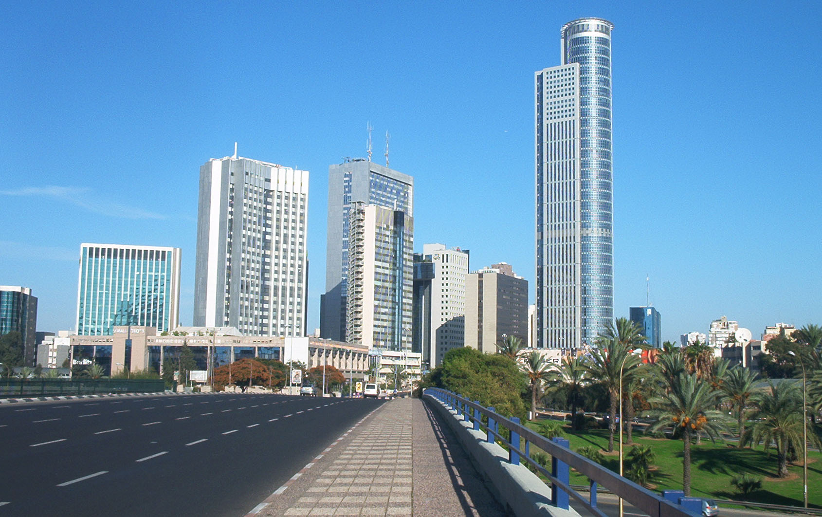
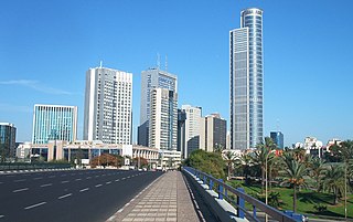
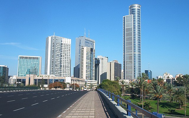
Ramat Gan towers photographed from Tel Aviv, Israel
| Camera location | | View this and other nearby images on: OpenStreetMap |
|---|

|
လိတ်ယာႏယိုနဝ်ꩻ အဝ်ႏ GNU Free Documentation License, ဗားသိဉ်း ၁.၂ မွေးတဝ်းလဲ့ Free Software Foundation ကို ကဖြေ့ꩻလီခါꩻဒါႏ ဗားသိဉ်းကရီးခါဗာႏမုဲင်ꩻတယဝ်း ဗားသိဉ်းတဗာႏဗာႏဆꩻလ့နဝ်ꩻ Invariant Sections, Front-Cover Texts တောမ်ႏ Back-Cover Texts ဖုံႏ ပါတဝ်းလဲ့ ထူႏကူꩻဗိုန်၊ တိုတ်ꩻဖြေ့ꩻလီ တောမ်ႏ/မွေးတဝ်းလဲ့ ဖျက်ပြောင်ꩻလုဲင်ꩻနွောင်ꩻတာႏ ဖေႏခါꩻဒျာႏအခွင်ꩻသွူ။ လုဲင်သိဉ်မူပွာꩻယို သော့ꩻခါꩻဒျာႏ GNU Free Documentation License ကတူႏစဲဉ်ႏကိုသွူ။ |
ဖုဲင်ယိုနဝ်ꩻ အွောန်ႏထွော့ခါꩻဒျာႏ တောမ်ႏ Creative Commons [[creativecommons
|
||
| ||
| This licensing tag was added to this file as part of the GFDL licensing update. |
| Annotations | This image is annotated: View the annotations at Commons |
ဖုဲင်မုဲင်တန်ꩻ
ဖေႏကထီႏလꩻ ဖုဲင်နဝ်ꩻမွူးနီꩻအတွိုင်ꩻနဝ်ꩻ နျꩻသွော့ မွူးနီꩻ/အခိန်ႏ တဗာႏဗာႏလောင်း ကလိစ်သြ။
| မွူးနီꩻ/အခိန်ႏ | နမူႏနာႏပွုံႏစံႏပေႏ | ဒုဲင်မဲဉ်းသိဉ်းဖုံႏ | ကေားသုင်ꩻသား | တောင်ꩻသေꩻ | |
|---|---|---|---|---|---|
| ယိုခါကျာꩻ | ၂၁:၃၃၊ ၉ ဖေဖော်ဝါရီ ၂၀၀၈ | | ၁၆၈၉ × ၁၀၆၂ (၃၃၀ KB) | Talgraf777 | {{Information |Description= |Source= |Date= |Author= |Permission= |other_versions= }} |
| ၀၃:၅၄၊ ၂၉ နိုဝဲင်ဗာ ၂၀၀၅ |  | ၁၇၉၂ × ၁၂၀၀ (၈၃၅ KB) | Itayba | Ramat Gan towers near Tel Aviv Israel |
သုင်ꩻဖုဲင်
လိတ်မဲ့ငါလ့နဝ်ꩻနဝ်ꩻ အဝ်ႏသွုံꩻခါꩻ ဖုဲင်ယိုသွူ:
ဂလိုဗယ် သုင်ꩻဖုဲင်
ဝီခီအလင်ဖုံႏကို အဝ်ႏသွုံꩻခါꩻ ဖုဲင်ယိုသွူ:
- သုင်ꩻအီ an.wikipedia.org ကို
- သုင်ꩻအီ ar.wikipedia.org ကို
- သုင်ꩻအီ ast.wikipedia.org ကို
- သုင်ꩻအီ az.wikipedia.org ကို
- သုင်ꩻအီ be.wikipedia.org ကို
- သုင်ꩻအီ bg.wikipedia.org ကို
- သုင်ꩻအီ ca.wikipedia.org ကို
- သုင်ꩻအီ cs.wikipedia.org ကို
- သုင်ꩻအီ da.wikipedia.org ကို
- သုင်ꩻအီ de.wikipedia.org ကို
- သုင်ꩻအီ en.wikipedia.org ကို
- သုင်ꩻအီ eo.wikipedia.org ကို
- သုင်ꩻအီ es.wikipedia.org ကို
- သုင်ꩻအီ et.wikipedia.org ကို
- သုင်ꩻအီ fa.wikipedia.org ကို
- သုင်ꩻအီ fa.wikivoyage.org ကို
- သုင်ꩻအီ fr.wikipedia.org ကို
- သုင်ꩻအီ gv.wikipedia.org ကို
- သုင်ꩻအီ he.wikipedia.org ကို
- သုင်ꩻအီ hu.wikipedia.org ကို
- သုင်ꩻအီ hy.wikipedia.org ကို
နွို့ထွား ကသုင်ꩻခါꩻအီဒါႏဖုဲင်ယို ခင်ႏလမ်းအလင်ဖုံႏကို။